Fishing the High Uintas: A Guide to Utah's High-Country Lakes
By Tiafau Purcell
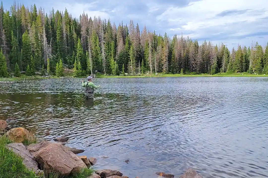
The hardest part about fishing the Uintas isn't finding a lake. It's deciding which one to explore.
Hundreds of fishable lakes are scattered across the range, from waters you can reach near a road to alpine basins that require hours of hiking. Some hold familiar brook trout and cutthroat, while others offer opportunities for Arctic grayling, tiger trout or even a rare golden trout. You could spend years exploring the Uintas and still have another lake waiting on the map.
There's Always Another Lake
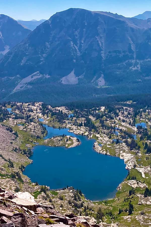
Pull up a map of the Uinta Mountains and start zooming in. It doesn't take long before blue dots seem to appear everywhere. Some are large, named lakes with established trails and campsites nearby. Others are small alpine waters tucked beneath ridgelines, several miles from the nearest road. Some receive plenty of visitors every summer, while others require enough effort to reach that you may have the shoreline mostly to yourself.
That's part of what makes fishing the Uintas different from fishing one of Utah's major reservoirs or rivers. You aren't choosing a single fishery. You're choosing from an entire mountain range. The Utah Division of Wildlife Resources has surveyed 1,036 lakes in the Uintas through a series of long-term studies. Of those, 446 are currently stocked on a prescribed cycle and another 129 have enough natural reproduction that they don't require stocking. More than 500 Uinta lakes support sportfish populations, but 461 of the lakes DWR surveyed are fishless.
So while there's no shortage of water, seeing a lake on a map doesn't necessarily mean there are fish in it. Doing a little research before you start hiking can make a big difference.
Start With a Drainage, Not a Lake
One of the easiest ways to make sense of the Uintas is to stop looking at the entire mountain range at once. Start with a drainage. Four of Utah's major rivers—the Provo, Weber, Duchesne and Bear—begin in the snowfields of the Uinta Mountains, and dozens of smaller drainages divide the range into more manageable areas. Each one has its own collection of lakes, trails, access points and fisheries.
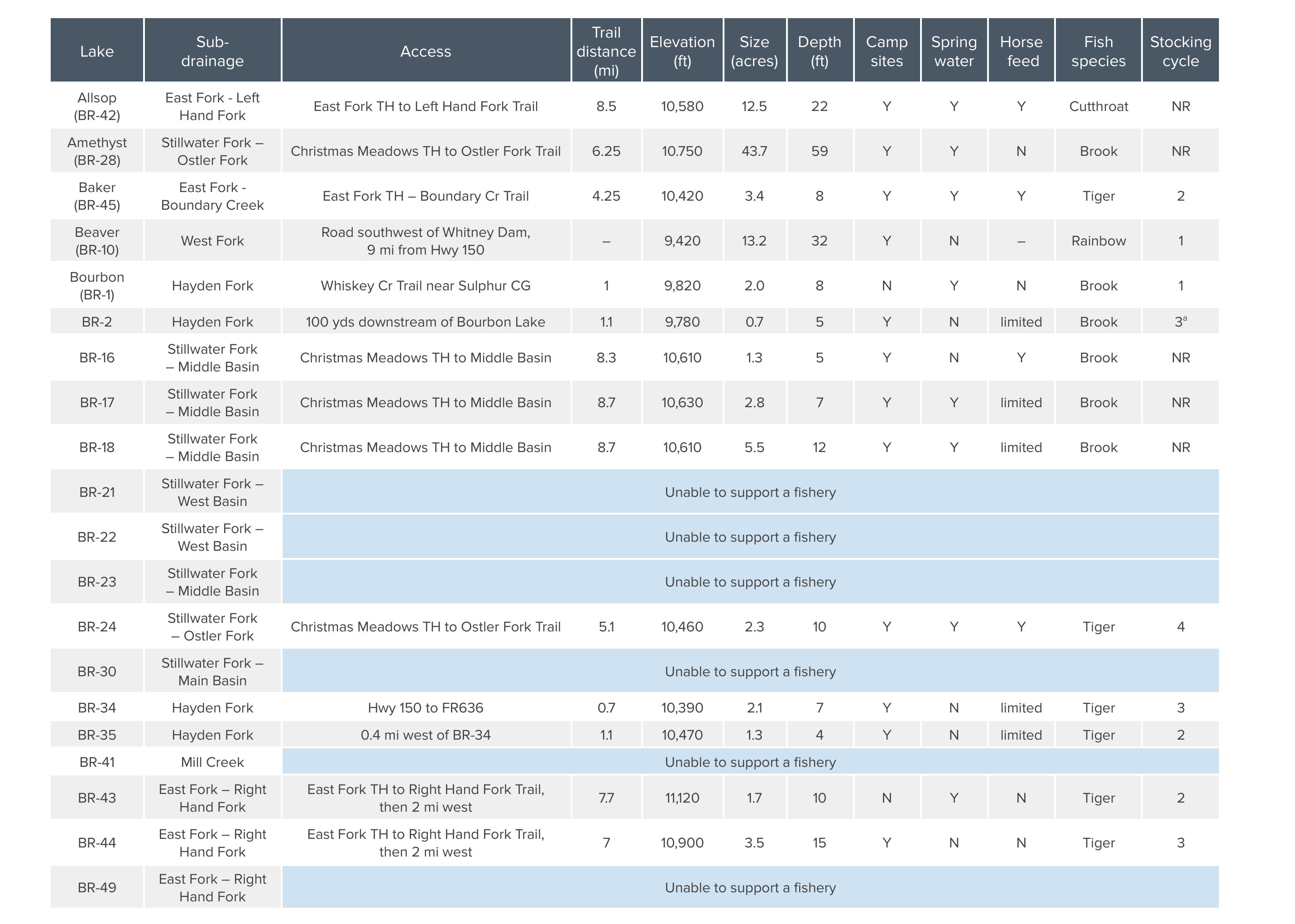
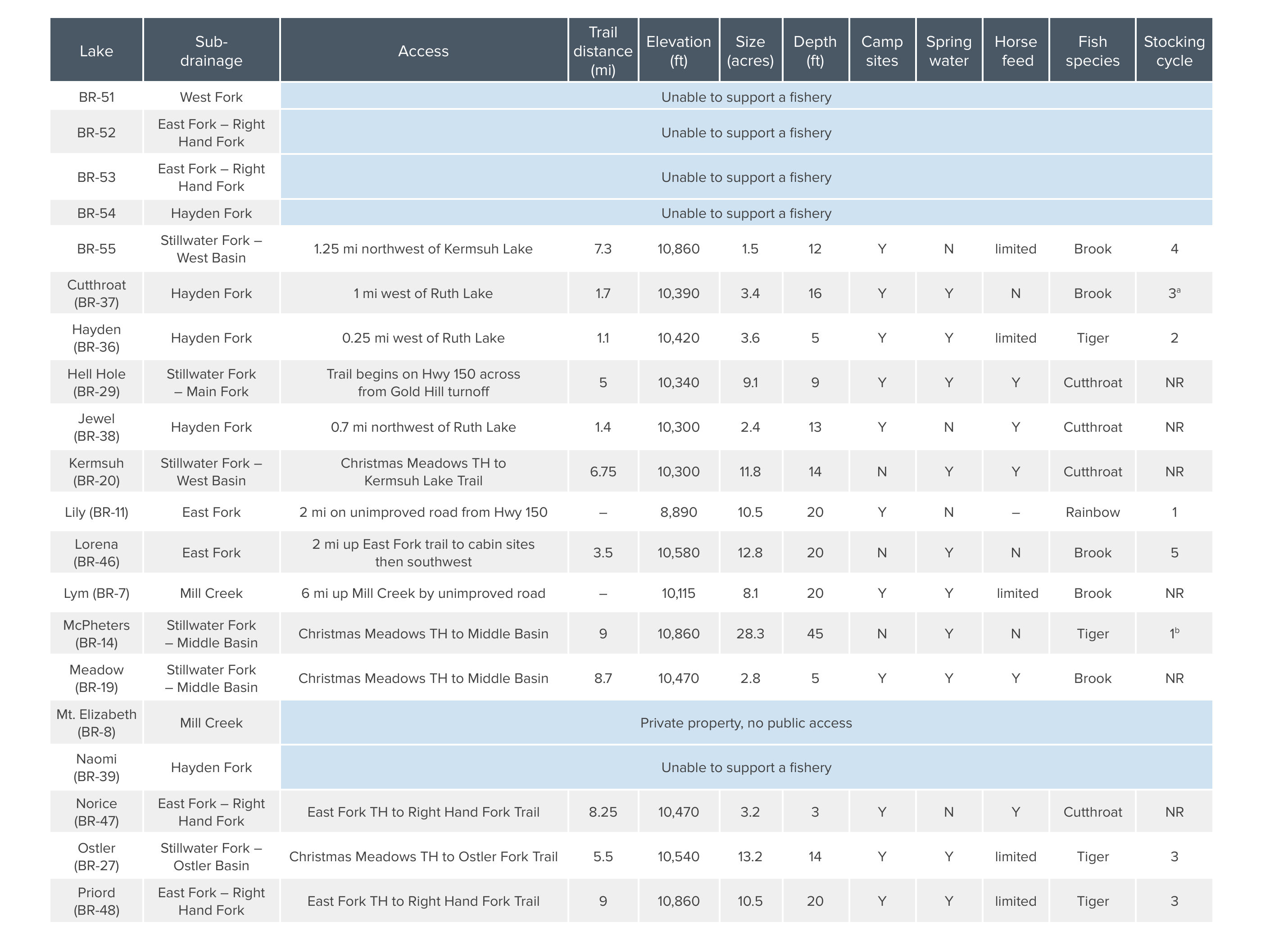
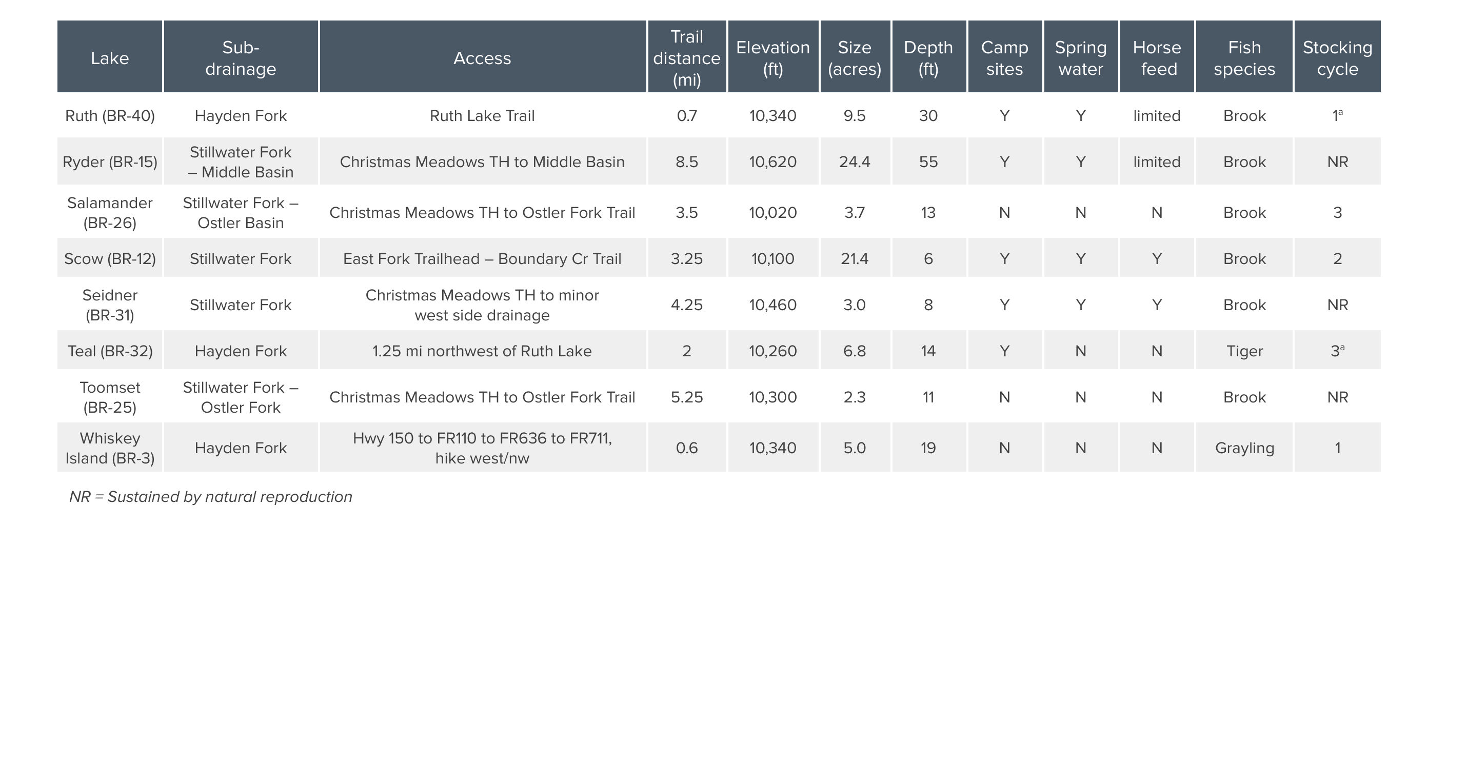
DWR has published detailed guides for several of these areas, including the Bear River, Blacks Fork and Whiterocks River drainages. Those guides are surprisingly useful because they don't simply tell you where a lake is. They include information about elevation, acreage, fish species, stocking cycles, survey results and access. The three drainages also show just how different fishing the Uintas can be.
Bear River Drainage
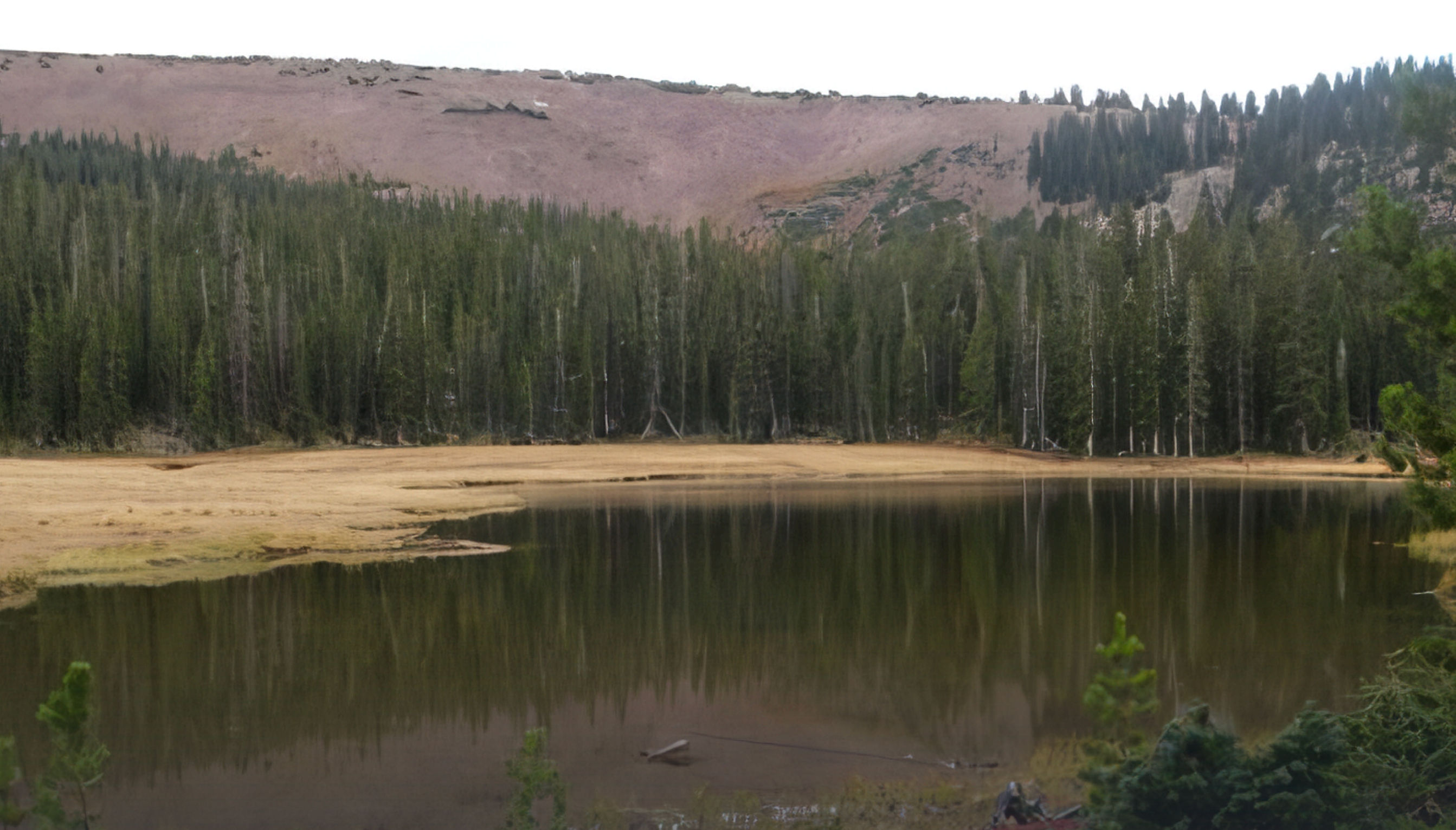
The Bear River drainage occupies the northwestern end of the Uintas and is the largest drainage in the range by land area. It contains more than 40 natural lakes along with numerous smaller ponds, and most of those waters require hiking even though Mirror Lake Highway provides relatively convenient access to the broader area.
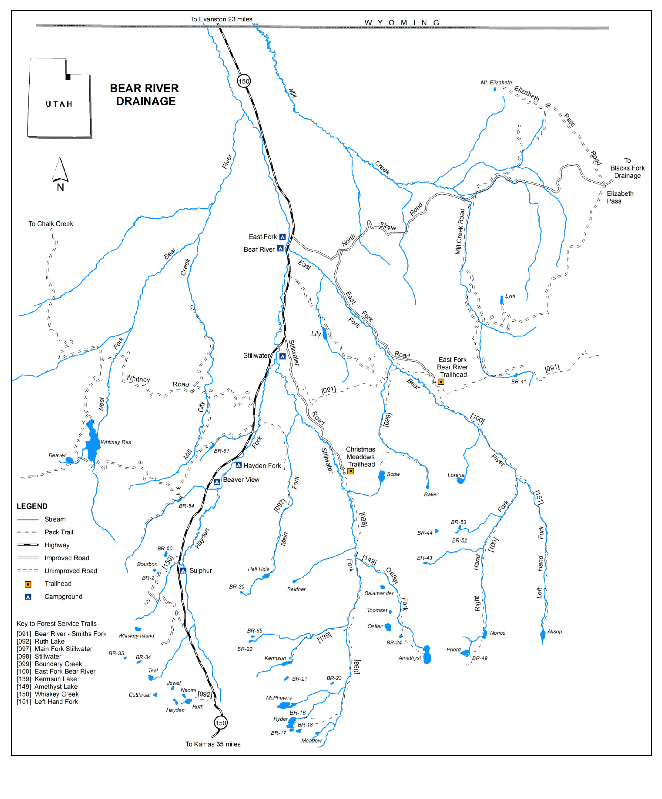
Brook, cutthroat and tiger trout can all be found in backcountry lakes here, with Arctic grayling present in some waters as well. The drainage also offers everything from relatively popular lakes near established trails to remote waters that receive much lighter fishing pressure. It's a good example of why you don't always need to travel to the farthest corner of the Uintas to find an adventure. Sometimes getting a little farther away from the most obvious trailhead is enough.
Blacks Fork Drainage
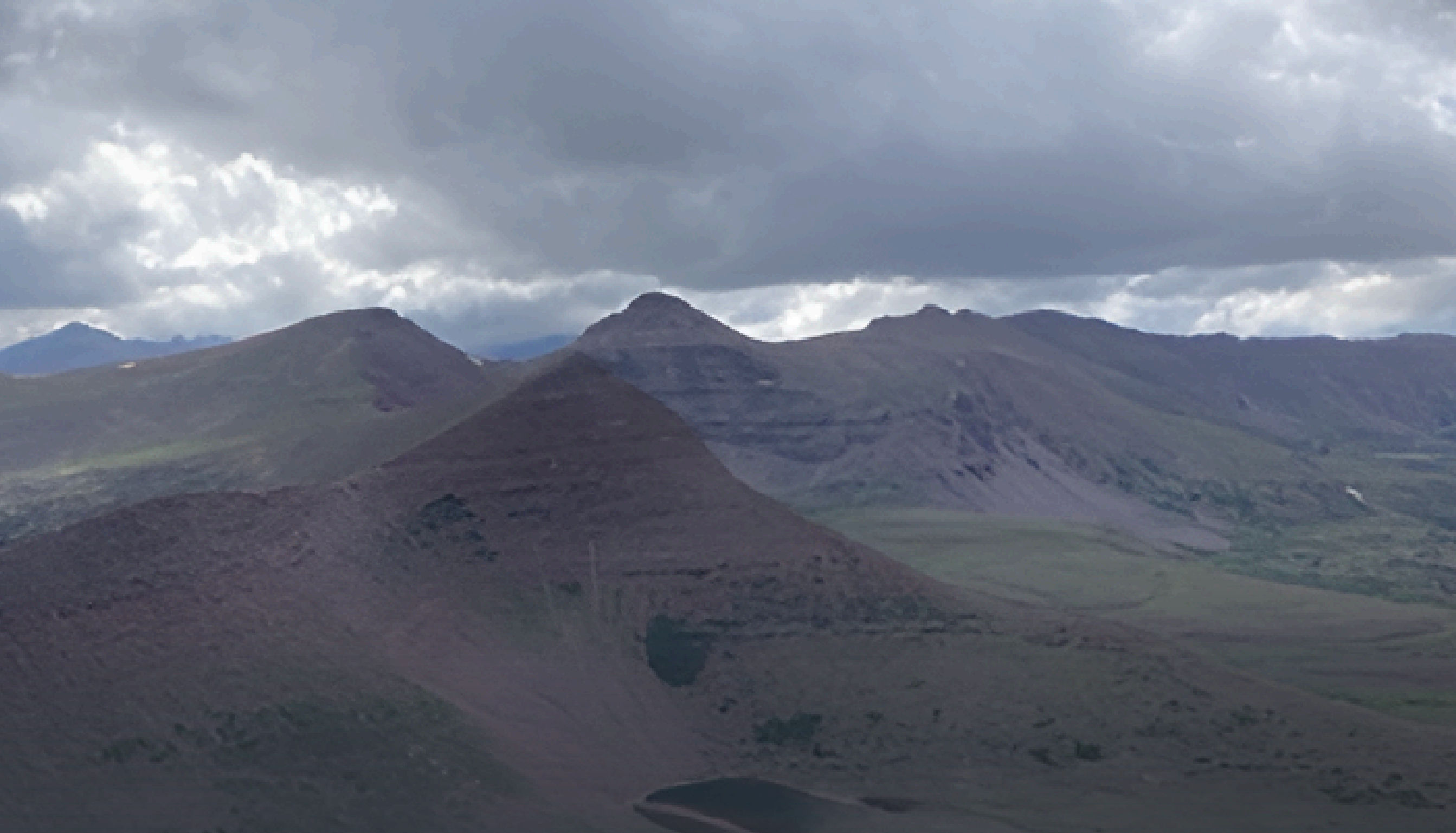
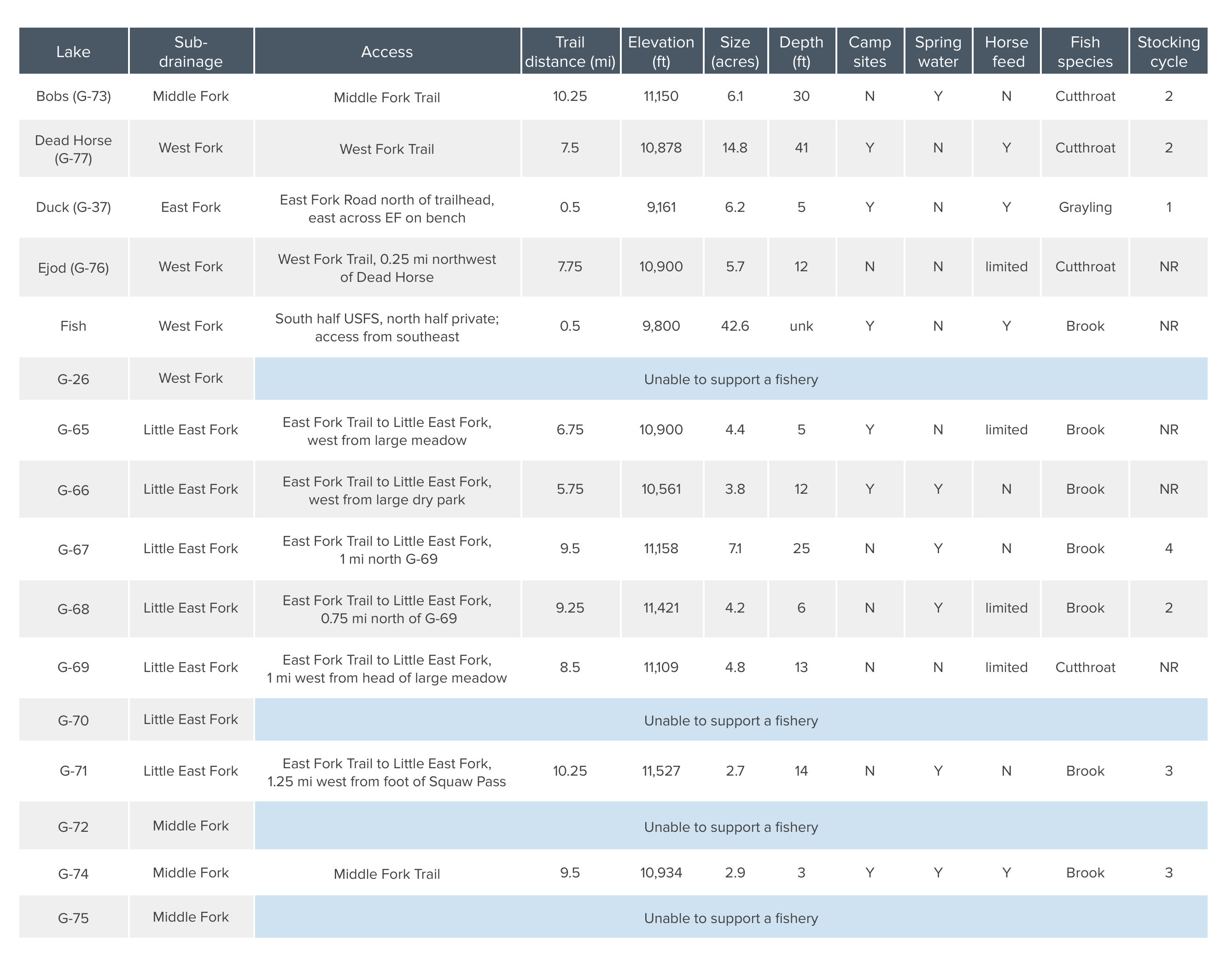
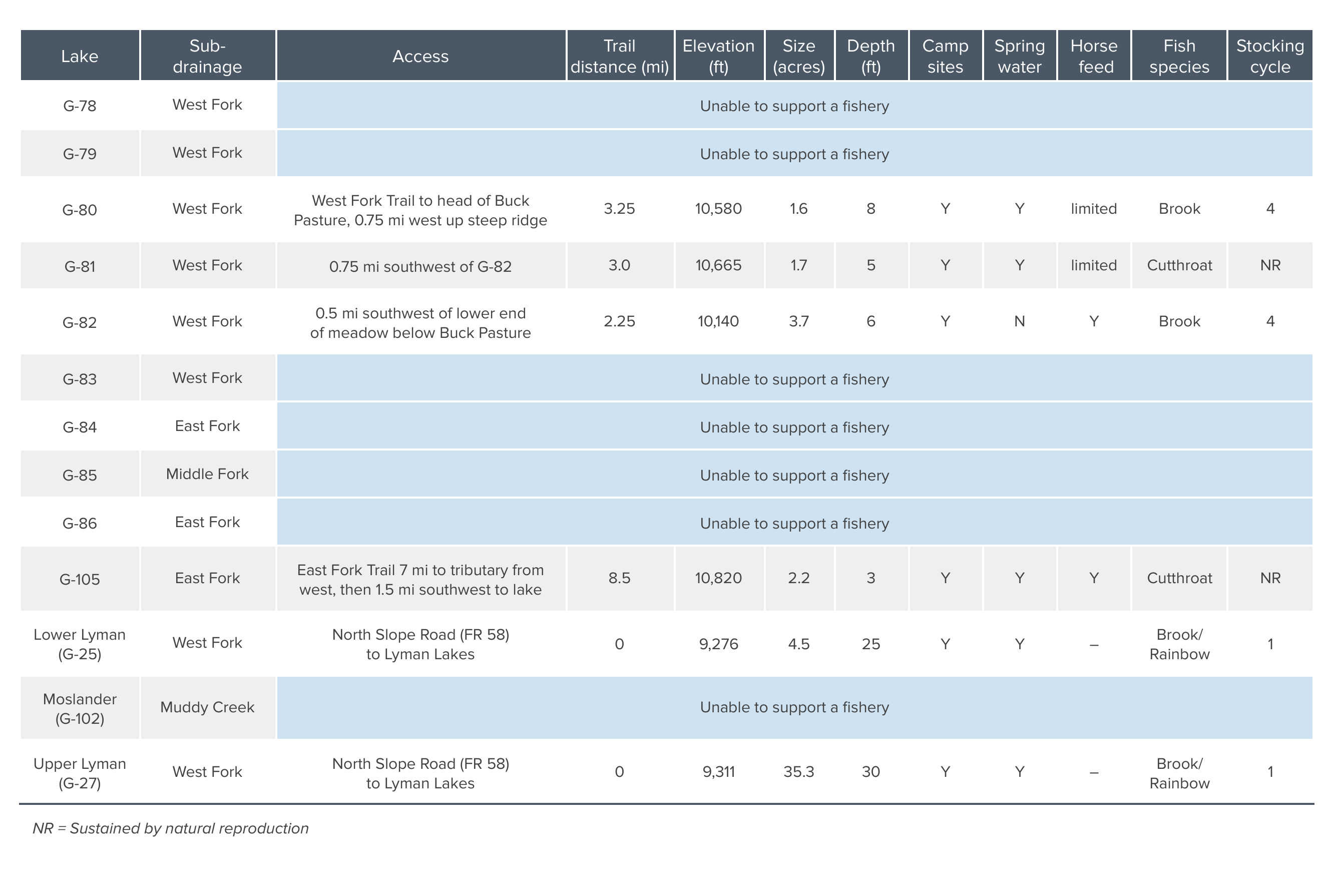
The Blacks Fork drainage feels different. Located on the north slope between the Bear River and Smiths Fork drainages, the basin is rugged and comparatively isolated. Its lakes are spread among four major forks, and nearly half of them sit at or above timberline. DWR describes recreational use and fishing pressure here as relatively light because many lakes are remote, trail maintenance can be limited and some waters require cross-country travel.
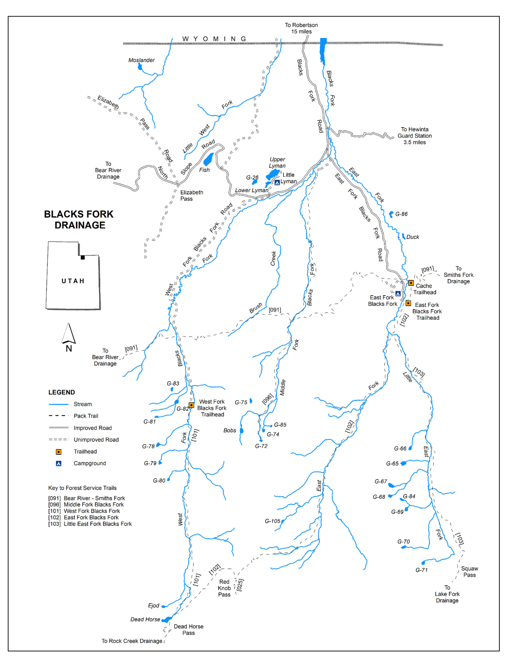
Brook and cutthroat trout are found throughout the backcountry fisheries, with populations supplemented by aerial stocking where necessary. For anglers who enjoy solitude and are comfortable traveling farther from established access, Blacks Fork is the kind of drainage that makes the Uintas feel very big.
Whiterocks River Drainage
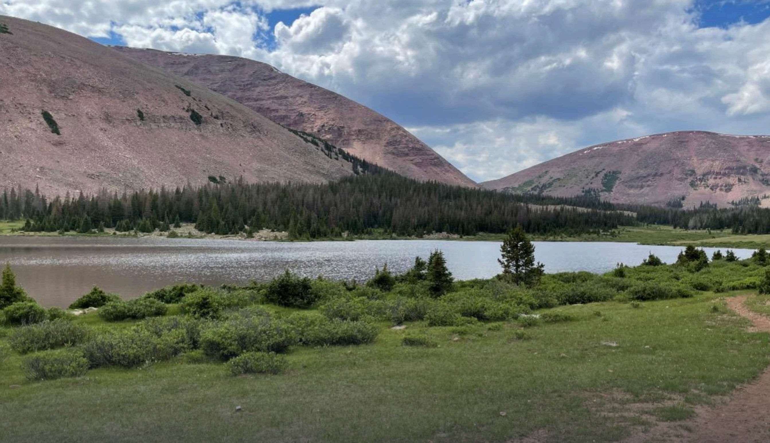
On the south slope, the Whiterocks River drainage provides another experience entirely. It's relatively accessible from the Uintah Basin and contains more than 70 natural lakes and ponds, 47 of which are actively managed for fish.
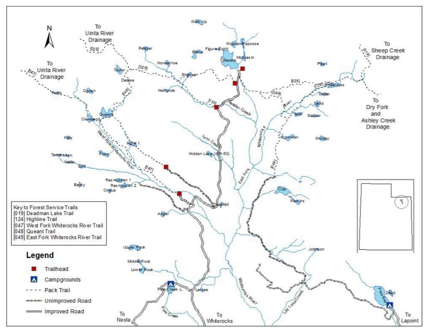
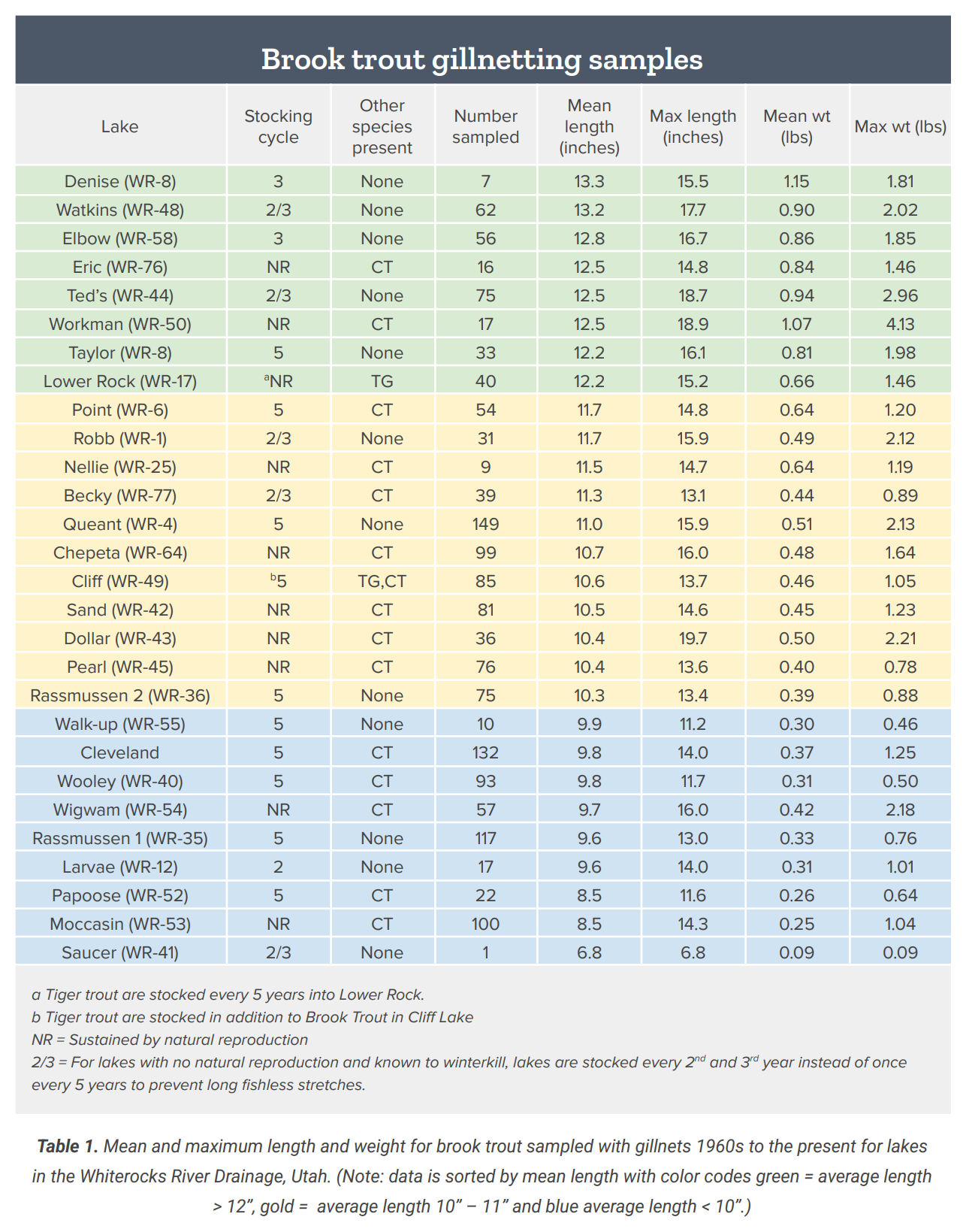
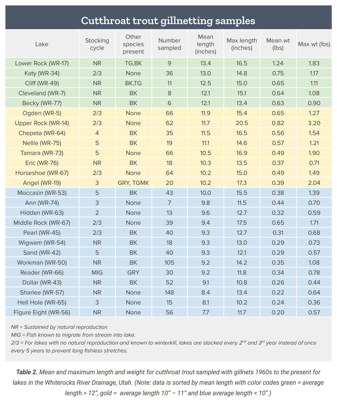
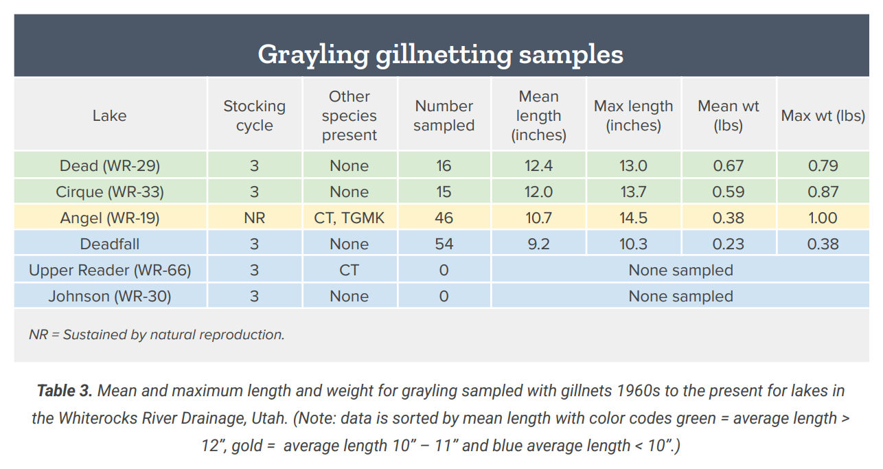
Brook trout are abundant, but the drainage also offers cutthroat trout and Arctic grayling opportunities. Some areas receive considerable fishing pressure because they're easier to reach, while other clusters of lakes see relatively few anglers even when they're not particularly far away. That's a pattern you'll notice throughout the Uintas. Fishing pressure tends to concentrate around a relatively small number of recognizable lakes. Walking a little farther or exploring another basin can completely change the experience.
The Fish of the High Uintas
Brook trout and cutthroat trout are the two species most commonly associated with Uinta mountain lakes, and DWR manages hundreds of waters primarily for those fish. They're well suited to the cold alpine environment and have proven capable of surviving where the growing season is short. But they're far from the only reason to bring a fishing rod.
Arctic grayling can be found in dozens of managed Uinta lakes, giving anglers the chance to catch one of Utah's most distinctive sportfish. Tiger trout are also present in a number of waters, while rainbow trout occur in others.
Then there are golden trout. Only a very small number of Uinta lakes are managed primarily for Golden Trout, which is one reason finding one can feel like such an accomplishment. If that's the fish you're looking for, we've written a separate FishRec Journal article about what makes Utah's Golden Trout fishery so unusual and why the trip is often as memorable as the fish.
One of the best things about exploring the Uintas is that you can choose a trip around the species you want to catch, or do the opposite and choose a lake you've never visited and see what you find.
How Did All These Fish Get Up There?
Standing beside an alpine lake several miles from a road raises an obvious question: how did the fish get here? For many Uinta lakes, the answer is an airplane. Utah has used aerial fish stocking since at least the 1950s. DWR currently stocks more than 300 remote lakes around the state by air each year, using a Cessna 185 equipped with a multi-chamber fish tank. The fish are tiny fingerlings, generally only one to three inches long, and are released while the aircraft flies roughly 50 to 150 feet above the water.
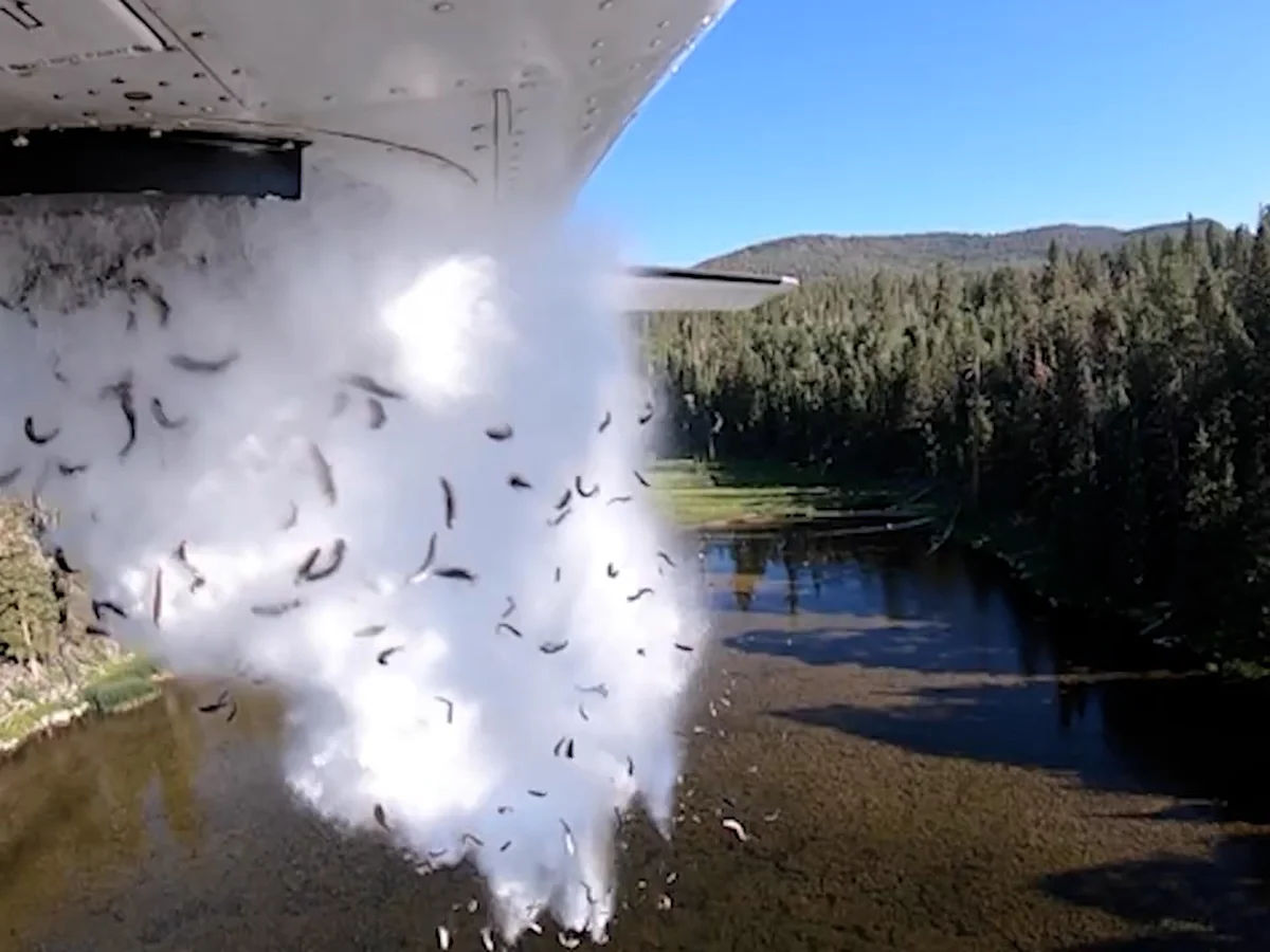
Brook trout, cutthroat trout, Arctic grayling, tiger trout, splake, rainbow trout and Golden Trout can all be stocked this way. Not every lake is stocked every year. More heavily fished waters may receive fish every one or two years, while remote lakes can be stocked on longer rotations. Some lakes don't need stocking at all because their fish populations reproduce naturally. That management is one reason there are so many different fishing opportunities scattered throughout the mountains.
Not Every Blue Spot on the Map Holds Fish
This is worth repeating because it's an easy mistake to make when planning a Uinta trip. Not every lake has fish. Of the 1,036 lakes included in DWR's long-term surveys, 461 were classified as fishless. Other lakes may experience winterkill, changing populations or management changes that make old information unreliable. That's why a forum post from 15 years ago shouldn't necessarily determine where you hike tomorrow.
Before committing to a long trip, check current information. FishRec can help you explore known fishing waters and see which species are associated with them, while DWR's stocking records and drainage guides provide another layer of information about how individual fisheries are being managed.
It's still fishing, so none of that guarantees you'll catch anything. It simply gives you a much better starting point.
Reading an Alpine Lake
When you finally reach the lake, resist the urge to immediately start casting from the first open piece of shoreline. Spend a few minutes looking at the water. Alpine lakes may look simple from a distance, but there's still structure beneath the surface. Look for inlet and outlet streams, rocky points, shelves that transition into deeper water, submerged boulders and areas where wind is pushing insects toward shore. On calm days you may be able to spot cruising trout or see rises that give away where fish are feeding.
Inlets can be especially interesting because moving water brings oxygen and food into the lake. Drop-offs give trout access to both shallow feeding areas and deeper security, while a windblown shoreline can concentrate insects and other food.
This is where FishRec's water recommendations can help as well. We'll help you understand the types of areas that may be worth casting toward and how to approach the water, but we're not going to give you someone's exact fishing spot or GPS coordinate. You still get to read the lake and find the fish yourself.
Keep the Fishing Simple
High-country fishing doesn't require hauling an entire tackle shop into your backpack. For fly anglers, a small selection of dry flies and nymphs can cover a lot of situations. Terrestrial patterns can also be effective when ants, beetles and other insects are finding their way onto the water.
Spin anglers can do well with lightweight spinners and spoons that are easy to carry and cast from shore. More important than having dozens of options is paying attention to what's happening when you arrive. If trout are rising, adjust accordingly. If you aren't seeing activity near shore, look for deeper water or structure. If one lake isn't producing, sometimes the best decision is simply to move. That's another advantage of the Uintas: there's often another lake nearby.
Don't Judge a Uinta Trout by Its Size
If you're used to fishing productive reservoirs, the average size of some high-country trout may surprise you. Growing seasons at these elevations are short. DWR notes that the optimum growing season can run only from June through September, and trout may reach only about 8 to 12 inches by their third year.
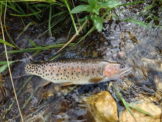
That's not necessarily a sign of a bad fishery. It's a reflection of the environment. A healthy 10-inch brook trout caught from a lake at 10,500 feet is a very different experience from catching the same-sized fish near a highway. When you've spent hours hiking into a basin and have mountains rising behind you, size tends to matter a little less.
The Mountains Can Change Quickly
Fishing may be the reason for the trip, but once you leave the road, you're traveling in mountain country. Weather in the Uintas can change quickly even during summer. DWR warns that snow showers are possible throughout the year at high elevations and temperatures can fall 20 to 30 degrees in a short period of time. Bring layers and rain gear even when the forecast looks good. Carry enough food and water, have a way to navigate without cell service and let someone know where you're going and when you expect to return. If you're relying on a phone for navigation, download what you need before leaving service.
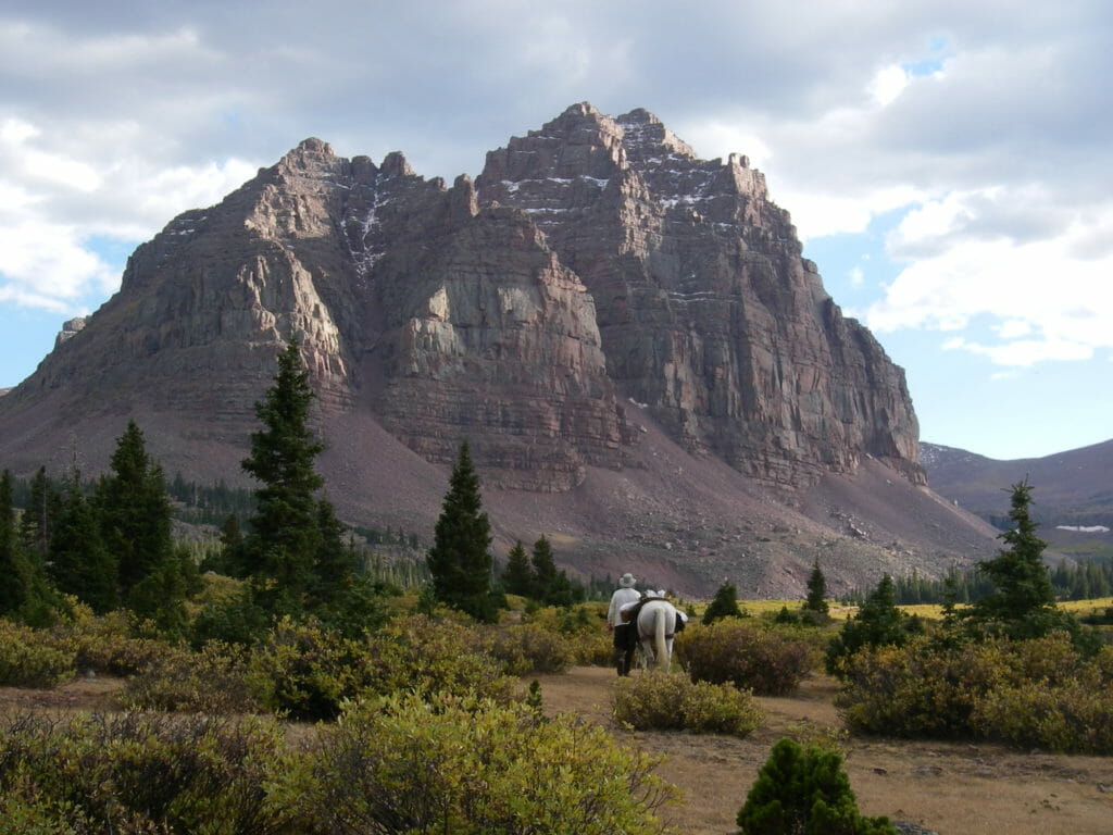
Afternoon thunderstorms deserve particular respect above timberline. If the weather begins turning, catching one more fish isn't worth being exposed on a ridge or shoreline during lightning. The Uintas will still be there next time.
Leave the High Country Better Than You Found It
The same remoteness that makes these lakes special also makes them vulnerable. Alpine vegetation grows slowly. Small lakes can't absorb fishing pressure the way a large reservoir can, and trash left behind may remain there long after the person who brought it has gone home.
Pack out fishing line, food wrappers and everything else you carried in. Avoid creating new campsites when established areas are available, protect shoreline vegetation and follow current Forest Service rules for camping and fires. Never move live fish from one water to another. Fish introductions can completely change small mountain ecosystems and threaten native species.
DWR is currently working to restore native Colorado River Cutthroat Trout in portions of the Uintas, including removing nonnative fish from selected waters where they threaten native populations. Protecting these fisheries sometimes means recognizing that not every lake should contain every species.
Find Your Own Uinta Lake
There's no single "best" lake in the Uintas. Maybe you're looking for brook trout with your kids and want a relatively short hike. Maybe you're trying to catch your first Arctic Grayling. Maybe you're willing to backpack deep into the mountains looking for Golden Trout, or you simply want to find a lake you've never seen before.
Start with the experience you want, then narrow things down. Choose a drainage. Look at the species. Check access and distance. Read the latest information. Have a backup lake or two nearby, because high-country fishing doesn't always go according to plan.
FishRec can help you explore Uinta waters by species and location, learn what's known about individual fisheries and get recommendations for approaching the water once you arrive. From there, the trip is yours. That's what makes the Uintas so much fun to fish. You don't need somebody else's secret spot. You just need a map, a little information and enough curiosity to see what's beyond the next trail.
And if the first lake doesn't produce? There's probably another blue spot on the map just over the ridge.